Earthquakes
RSOE EDIS
| Date/Time (UTC) | Magnitude | Area | Country | State/Prov./Gov. | Location | Risk | Source | Details | ||
| 16.08.2012 20:25:34 | 2.4 | North America | United States | Alaska | Pedro Bay | USGS-RSOE |  |
|||
| 16.08.2012 20:10:24 | 2.5 | North America | United States | Alaska | Pedro Bay | USGS-RSOE | |
|||
| 16.08.2012 20:10:44 | 2.6 | North America | United States | Alaska | Pedro Bay | USGS-RSOE | |
|||
| 16.08.2012 20:15:19 | 2.5 | Asia | Georgia | Bakurianis Andeziti | EMSC | |
||||
| 16.08.2012 19:56:29 | 2.0 | North America | United States | California | Cobb | USGS-RSOE | |
|||
| 16.08.2012 20:15:41 | 4.4 | Asia | Taiwan | Taiwan | Buli | EMSC | |
|||
| 16.08.2012 20:16:02 | 2.6 | Europe | Greece | West Greece | Aitoliko | EMSC | |
|||
| 16.08.2012 20:16:21 | 2.5 | Europe | Greece | Central Greece | Kamena Vourla | EMSC | |
|||
| 16.08.2012 20:16:40 | 4.5 | Middle-East | Iran | East Azarbaijan | Ahar | EMSC | |
|||
| 16.08.2012 19:11:36 | 2.0 | North America | United States | Washington | Ashford | USGS-RSOE | |
|||
| 16.08.2012 19:10:25 | 2.4 | Asia | Turkey | Sakarya | Ferizli | EMSC | |
|||
| 16.08.2012 18:35:55 | 2.0 | North America | United States | Alaska | Nanwalek | USGS-RSOE | |
|||
| 16.08.2012 19:10:50 | 2.2 | Asia | Turkey | I?d?r | Karakoyunlu | EMSC | |
|||
| 16.08.2012 18:10:20 | 3.7 | Middle-East | Iran | East Azarbaijan | Ahar | EMSC | |
|||
| 16.08.2012 18:10:48 | 2.6 | Europe | Italy | Sicily | Acque Dolci | EMSC | |
|||
| 16.08.2012 18:11:07 | 4.0 | Indonesian Archipelago | East Timor | Gunung Dilarini | EMSC | |
||||
| 16.08.2012 17:10:21 | 2.6 | Europe | Greece | Peloponnese | Khora | EMSC | |
|||
| 16.08.2012 17:10:50 | 5.2 | Africa | Sierra Leone | Southern Province | Bonthe | EMSC | |
|||
| 16.08.2012 16:35:31 | 5.3 | Africa | Sierra Leone | Southern Province | Bonthe | USGS-RSOE | |
|||
| 16.08.2012 16:10:23 | 2.2 | Asia | Turkey | Sivas | Nasir | EMSC | |
|||
| 16.08.2012 16:10:46 | 4.9 | South-America | Chile | Ostrov Paskhi | EMSC | |
||||
| 16.08.2012 15:55:34 | 4.9 | South America | Chile | Ostrov Paskhi | USGS-RSOE | |
||||
| 16.08.2012 15:05:20 | 2.3 | Europe | Italy | Sicily | Acque Dolci | EMSC | |
|||
| 16.08.2012 15:05:47 | 4.9 | South-America | Brazil | Ceará | Acarau | EMSC | |
|||
| 16.08.2012 15:08:28 | 4.9 | South America | Brazil | Ceará | Acarau | USGS-RSOE | |
|||
| 16.08.2012 15:06:06 | 4.4 | Pacific Ocean – East | Fiji | Northern | Lambasa | EMSC | |
|||
| 16.08.2012 15:00:57 | 4.4 | Pacific Ocean | Fiji | Northern | Lambasa | USGS-RSOE | |
|||
| 16.08.2012 15:06:26 | 3.5 | Asia | Turkey | Kahramanmara? | Pazarcik | EMSC | |
|||
| 16.08.2012 15:06:48 | 3.4 | Asia | Turkey | Kahramanmara? | Pazarcik | EMSC | |
|||
| 16.08.2012 14:30:31 | 4.9 | South America | Brazil | Ceará | Acarau | USGS-RSOE | |
|||
| 16.08.2012 15:07:09 | 4.9 | South-America | Brazil | Ceará | Acarau | EMSC | |
|||
| 16.08.2012 14:00:22 | 2.2 | Europe | Croatia | Istarska | Banjole | EMSC | |
|||
| 16.08.2012 13:05:37 | 3.0 | North America | United States | Alaska | Karluk | USGS-RSOE | |
|||
| 16.08.2012 12:56:52 | 2.0 | North America | United States | Alaska | Anchor Point | USGS-RSOE | |
|||
| 16.08.2012 12:55:25 | 2.8 | Europe | Greece | Peloponnese | Elafonisos | EMSC | |
|||
| 16.08.2012 12:55:49 | 4.8 | Asia | Japan | Akita | Kakudate | EMSC | |
|||
| 16.08.2012 12:20:32 | 4.3 | Asia | Japan | Akita | Takanosu | USGS-RSOE | |
|||
| 16.08.2012 11:50:28 | 2.1 | Asia | Turkey | Mu?la | Yatagan | EMSC | |
|||
| 16.08.2012 11:50:48 | 3.0 | Asia | Turkey | Van | Toyga | EMSC | |
|||
| 16.08.2012 11:51:09 | 2.0 | Asia | Turkey | Bingöl | Yayladere | EMSC | |
|||
| 16.08.2012 10:47:37 | 3.7 | North America | United States | Hawaii | Volcano | USGS-RSOE | |
|||
| 16.08.2012 10:45:29 | 2.8 | Europe | Greece | Peloponnese | Methoni | EMSC | |
|||
| 16.08.2012 10:45:55 | 2.1 | Asia | Turkey | Adana | Kadirli | EMSC | |
|||
| 16.08.2012 10:46:26 | 3.0 | Asia | Turkey | Gaziantep | Yalnizbag | EMSC | |
|||
| 16.08.2012 10:46:49 | 2.2 | Asia | Turkey | ?zmir | Karaburun | EMSC | |
|||
| 16.08.2012 10:47:11 | 2.2 | Europe | Greece | North Aegean | Agios Ilias | EMSC | |
|||
| 16.08.2012 09:45:24 | 2.4 | Europe | Italy | Sicily | Rodi | EMSC | |
|||
| 16.08.2012 09:10:36 | 2.3 | North America | United States | California | Lake Elsinore | USGS-RSOE | |
|||
| 16.08.2012 09:45:53 | 2.2 | Europe | Italy | Sicily | Acque Dolci | EMSC | |
|||
| 16.08.2012 08:50:32 | 5.0 | Pacific Ocean | Fiji | Northern | Lambasa | USGS-RSOE | |
|||
**********************************************************************************************************
Volcanic Activity
Popocatépetl volcano
Volcano Discovery
Central Mexico, 19.02°N / -98.62°W
Current status: erupting (4 out of 5)
Popocatépetl webcams / live data
Typical eruption style: Dominantly explosive, construction of lava domes. Plinian eruptions at intervals of several centuries or few thousands of years, vulcanian and strombolian activity in intermittent phases.
Popocatépetl volcano eruptions: 1345-47, 1354, 1363(?), 1488, 1504, 1509(?), 1512, 1518, 1519-23(?), 1528, 1530, 1539-40, 1542, 1548, 1571, 1580, 1590, 1592-94, 1642, 1663-65, 1666-67, 1697, 1720, 1802-04, 1827(?), 1834(?), 1852(?), 1919-22, 1923-24, 1925-27(?), 1933, 1942-43, 1947, 1994-95, 1996-2003, 2004-ongoing
Last earthquakes nearby: No recent earthquakes
Popocatepetl is one of Mexico’s most active volcanoes. After almost 50 years of dormancy, “Popo” came back to life in 1994 and has since then been producing powerful explosions at irregular intervals.
In the past centuries befor European invasions, large eruptions produced giant mud flows that have buried Atzteque settlements, even entire pyramids.
Background:
Volcán Popocatépetl, whose name is the Aztec word for smoking mountain, towers to 5426 m 70 km SE of Mexico City to form North America’s 2nd-highest volcano. The glacier-clad stratovolcano contains a steep-walled, 250-450 m deep crater. The generally symmetrical volcano is modified by the sharp-peaked Ventorrillo on the NW, a remnant of an earlier volcano.
At least three previous major cones were destroyed by gravitational failure during the Pleistocene, producing massive debris-avalanche deposits covering broad areas south of the volcano. The modern volcano was constructed to the south of the late-Pleistocene to Holocene El Fraile cone. Three major plinian eruptions, the most recent of which took place about 800 AD, have occurred from Popocatépetl since the mid Holocene, accompanied by pyroclastic flows and voluminous lahars that swept basins below the volcano. Frequent historical eruptions, first recorded in Aztec codices, have occurred since precolumbian time.
—
Source: GVP, Smithsonian Institution – Popocatepetl information
| Today | Volcano Eruption | Russia [Asia] | Kuril Islands, [Complex volcanoes of Ivan Grozny] |  |
|
| 16.08.2012 01:58 PM | Kuril Islands, Russia [Asia] | Complex volcanoes of Ivan Grozny | Volcano Eruption | 0900-07= | Complex volcanoes | No. 0 | |
Volcano Eruption in Russia [Asia] on Thursday, 16 August, 2012 at 13:58 (01:58 PM) UTC.
| Description | |
| A volcano erupted on one of Russia’s far eastern Kuril Islands, releasing a cloud of noxious fumes and raising temperatures in the surrounding area. Emergency officials said in a statement on their website that the volcano, called Ivan the Terrible and located on the sparsely populated island of Iturup to the south of the Kuril archipelago, erupted Wednesday due to increased water flows rushing into the volcano after heavy downpours. Officials stressed that the volcano had released no lava and that it erupts regularly, adding that the last major eruption was in 1989. According to the statement, Iturup residents were exposed to a slight smell of hydrogen peroxide and noticed ash falling as a result of the eruption. By Thursday, the hydrogen peroxide fumes and ash were no longer noticeable. Emergency officials advised citizens to steer clear of Ivan the Terrible and said they were monitoring the volcano’s activity. |
***********************************************************************************************************
Extreme Temperatures/ Weather
The Mississippi River Is Drying Up As Food Prices Continue To Surge (MOO, DBA, UNG, USO, JJG)
 Michael Snyder: The worst drought in more than 50 years is having a devastating impact on the Mississippi River. The Mississippi has become very thin and very narrow, and if it keeps on dropping there is a very real possibility that all river traffic could get shut down. And considering the fact that approximately 60 percent of our grain (NYSEARCA:JJG), 22 percent of our oil (NYSEARCA:USO) and natural gas (NYSEARCA:UNG), and and one-fifth of our coal travel down the Mississippi River, that would be absolutely crippling for our economy. It has been estimated that if all Mississippi River traffic was stopped that it would cost the U.S. economy 300 million dollars a day. So far most of the media coverage of this historic drought has focused on the impact that it is having on farmers and ranchers, but the health of the Mississippi River is also absolutely crucial to the economic success of this nation, and right now the Mississippi is in incredibly bad shape. In some areas the river is already 20 feet below normal and the water is expected to continue to drop. If we have another 12 months of weather ahead of us similar to what we have seen over the last 12 months then the mighty Mississippi is going to be a complete and total disaster zone by this time next year.
Most Americans simply do not understand how vitally important the Mississippi River is to all of us. If the Mississippi River continues drying up to the point where commercial travel is no longer possible, it would be an absolutely devastating blow to the U.S. economy.
Unfortunately, vast stretches of the Mississippi are already dangerously low. The following is an excerpt from a transcript of a CNN report that aired on August 14th….
The Euro’s Demise Has Been Set in Motion: Are you protected?
“Nationalism will emerge. Healthier countries will not see fit to spend their hard earned money to bail out their less responsible neighbors.”
CLICK HERE to get your Free E-Book, “Why It’s Curtains for the Euro”
You might think this is some kind of desert just outside of Memphis. It’s not. I’m actually standing on the exposed bottom of the Mississippi River. That’s how dramatic the drought impact is being felt here. Hard to believe, a year ago we were talking about record flooding. Now, they are worried about a new kind of record: a record low. The river was three miles wide here, it’s now down to three tenths of a mile. And that’s causing all kinds of problems. There are some benefits, I mean, take a look over here: new beach front. In fact, some quip that now the Mississippi River has more beaches than the entire state of Florida, which would be funny if it didn’t have an impact on trade.
A lot of stuff we use goes up and down the Mississippi River. We are talking steel, coal, ore, grain. The problem is now a lot of those barges have had to lighten their loads, and even doing that, they are still running aground. There is a real fear that there could be a possibility of closing the Mississippi River. If that happens, well, all that product that used to be carried cheaply by barge is now going to be carried more expensively by truck or train. And guess who is going to pay for all of that.
You can see video footage of what is happening along the Mississippi right here.
It really is amazing that last year we were talking about historic flooding along the Mississippi and this year we are talking about the Mississippi possibly drying up.
As I mentioned earlier, there are some areas along the river that are already 20 feet below normal levels. The following is from a recent article posted on inquisitr.com….
Just outside of Memphis the river is 13 feet below normal depth while the National Weather Service says Vicksburg, Mississippi is 20 feet below normal levels. Overall the Mississippi is 13 feet below normal averages for this time of year.
The drying up river is forcing barge, tugboat and towboat operators to navigate narrower and more shallow spots in the river, slowing their speeds as they pass dangerously close to one another. In some parts of the Mississippi the river is so narrow that one-way traffic is being utilized.
A lot of barges have been forced to go with greatly reduced loads so that they will sit higher in the river, and other commercial craft have been forced to stop operating completely.
For example, the Mississippi has dropped so low at this point that the famous American Queen Steamboat can no longer safely navigate the river.
Down south, the Mississippi River has gotten so low that saltwater is actually starting to move upriver. The U.S. Army Corps of Engineers is fighting hard to keep that contained.
Other waterways in the middle part of the country are in even worse shape.
For example, a 100 mile stretch of the Platte River has already dried up. Millions of fish are dying as rivers and streams all over the country continue to get shallower and warmer as a result of the ongoing drought.
The last time the condition of the Mississippi River was this bad was back in 1988. At that time, a lot of barge traffic was stopped completely and the shipping industry lost approximately a billion dollars.
If a similar thing were to happen now, the consequences could potentially be far worse.
As I wrote about recently, a standstill along the Mississippi would cost the U.S. economy about 300 million dollars a day.
In fact, one towing company that works on the Mississippi says that it has already been losing about $500,000 a month since May.
In the end, who is going to pay for all of this?
You and I will. GET A FREE TREND ANALYSIS FOR ANY STOCK HERE!
In fact, this crisis could end up costing American consumers a whole lot of money….
So here’s the math. If you want to raise the average barge one inch above the water, you’ve got to take off 17-tons of cargo. To raise it a foot, you’re talking 200 tons.
And since, according to the American Waterways Operators, moving cargo by river is $11 a ton cheaper than by train or truck. The more that now has to be moved on land, well, the more the costs go up. Steven Barry says, “And, eventually, the consumer’s gonna pay that price
somewhere along the line.”
And considering the fact that we are already facing a potential food crisis due to the drought, the last thing we need is for the Mississippi River to dry up.
So is there any hope on the horizon for the Mississippi?
Unfortunately, things do not look promising.
The fall and the winter are typically drier than the summer is along the Mississippi River. That means that conditions along the river could actually get even worse in the months ahead. The following is from a recent Time Magazine article….
But without significant rainfall, which isn’t in any long-range forecasts, things are likely to get worse. As summer turns to fall, the weather tends to get drier. Lower temperatures generally mean fewer thunderstorms and less rainfall.
“Take away the thunderstorm mechanism and you run into more serious problems,” says Alex Sosnowski, expert senior meteorologist for AccuWeather.com. And while droughts tend to be a temporary setback, longer-range forecasts are troublesome. Sosnowski says he is anticipating an El Niño weather pattern next year, which would mean below-normal snowfall and above-average temperatures.
Let us hope and pray that we don’t see another 12 months similar to the 12 months that we have just been through.
The U.S. economy is already in bad enough shape.
We don’t need any more major problems on top of what we are already dealing with.
So what do you think about this? Please feel free to post a comment with your thoughts below….
Related: PowerShares DB Agriculture (NYSEARCA:DBA), Market Vectors Agribusiness ETF (NYSEARCA:MOO).
Written By Michael Snyder From The Economic Collapse
Michael has an undergraduate degree in Commerce from the University of Virginia and a law degree from the University of Florida law school. He also has an LLM from the University of Florida law school. Michael has worked for some of the largest law firms in Washington D.C., but now is mostly focus on trying to make a difference in the world.
| Today | Extreme Weather | Artic | [Arctic Ocean] | |
|
Extreme Weather in Artic on Thursday, 16 August, 2012 at 04:53 (04:53 AM) UTC.
| Description | |
| An unusually strong storm formed off the coast of Alaska on August 5 and tracked into the center of the Arctic Ocean, where it slowly dissipated over the next several days. The Moderate Resolution Imaging Spectroradiometer (MODIS) on NASA’s Aqua satellite captured this natural-color mosaic image on Aug. 6, 2012. The center of the storm at that date was located in the middle of the Arctic Ocean. The storm had an unusually low central pressure area. Paul A. Newman, chief scientist for Atmospheric Sciences at NASA’s Goddard Space Flight Center in Greenbelt, Md., estimates that there have only been about eight storms of similar strength during the month of August in the last 34 years of satellite records. “It’s an uncommon event, especially because it’s occurring in the summer. Polar lows are more usual in the winter,” Newman said. Arctic storms such as this one can have a large impact on the sea ice, causing it to melt rapidly through many mechanisms, such as tearing off large swaths of ice and pushing them to warmer sites, churning the ice and making it slushier, or lifting warmer waters from the depths of the Arctic Ocean. “It seems that this storm has detached a large chunk of ice from the main sea ice pack. This could lead to a more serious decay of the summertime ice cover than would have been the case otherwise, even perhaps leading to a new Arctic sea ice minimum,” said Claire Parkinson, a climate scientist with NASA Goddard. “Decades ago, a storm of the same magnitude would have been less likely to have as large an impact on the sea ice, because at that time the ice cover was thicker and more expansive.” Aqua passes over the poles many times a day, and the MODIS Rapid Response System stitches together images from throughout each day to generate a daily mosaic view of the Arctic. This technique creates the diagonal lines that give the image its “pie slice” appearance. |
……………………………..
| Today | Forest / Wild Fire | Canada | Province of British Columbia, [About 15 kilometres northeast of Squamish] | |
|
Forest / Wild Fire in Canada on Thursday, 16 August, 2012 at 08:26 (08:26 AM) UTC.
| Description | |
| A small forest fire ignited on a cliff face about 15 kilometres northeast of Squamish on Wednesday afternoon, engulfing a five-hectare stretch of trees but posing no threat to people or buildings. Shortly after 4 p.m., the Wildfire Management Branch sent in a repel crew – a three-person initial attack team – to climb down to the blaze from helicopter ropes. With a steep cliff face and no roads, the mountain allows no access except via helicopter, said Coastal Fire Centre spokeswoman Donna MacPherson. A shallow fissure running along the cliff face accelerated the flames – reported by Squamish residents – and funnelled them upward, she said. “If you look closely it looks like there’s an indentation on the cliff.We call it a chimney. And it acts just like a chimney, so that hot air has a tendency to rise up those chimneys that are on the sunny slope,” she said. “It created quite a plume, I guess the people in Squamish could see it.” The repel team later called in an air crew to establish a retardant line at the “head” of the blaze, which had nearly spread into the alpine, by dropping hundreds of gallons of retardant. “They put a retardant line on the top because the fire was going uphill – fire has a tendency to burn uphill,” MacPherson said. As night fell, the repel crew was constructing a makeshift helicopter pad by clearing a small area of forest and building a deck using logs like stilts to prop up the structure on the steeply sloped mountain side, she said. “They’ll feel the trees and cut the logs and then build a little log structure,” MacPherson said, adding the battle will likely continue for several days. “It’s going to be hard work for the crews. It’s incredibly hot up there and we’re going into a hot weekend. Also, we won’t be able to get any machinery in there at all, it’s going to be done all by hand I think the crews are going to have a rough time on this one,” she said. Where terrain allows, crews will typically employ bulldozers, excavators and “feller bunchers” – claw-like industrial arms atop a pair treads – to make no-cross fire trenches more quickly.MacPherson said Coastal Fire Centre members were figuring out a plan Wednesday night for how to battle the blaze Thursday. A lightning storm moved through the Squamish area over a week ago, making a tinderbox of the mountainous region by sparking embers that didn’t ignite immediately into a full-blown wildfire. “When that kind of thing happens, the fire will be retarded. It will smoulder underground or inside of a tree, and it will wait until things are dry enough that it pops to the surface,” MacPherson said. Crews normally stationed in the Interior recently came to the coast in anticipation of area fires. |
| Today | Forest / Wild Fire | Bulgaria | Burgas Region, [Nesebar and Pomorie] |  |
|
Forest / Wild Fire in Bulgaria on Thursday, 16 August, 2012 at 17:08 (05:08 PM) UTC.
| Description | |
| An emergency situation has been called in southern Bulgarian Black Sea resorts of Nesebar and Pomorie just south of Sunny Beach over a sizeable wildfire blazing for a second day. Some 2,500 acres of of pine and deciduous forests and dry grass and bushes along the road in the Dyulinski Pass. Over 150 firefighters and military servicemen have taken part in extinguishing the fire, aided by two helicopters. However, the situation has been complicated by the arid weather and especially by the hard terrain, leading Burgas Region vice-governor Atanas Terziev to declare an emergency situation in the two municipalities. Work for managing the fire is continuing Thursday evening. There is no danger for nearby settlements and resorts, report authorities. |
| Today | Forest / Wild Fire | USA | State of Idaho, [Trinity Ridge] | |
|
Forest / Wild Fire in USA on Thursday, 16 August, 2012 at 08:16 (08:16 AM) UTC.
| Description | |
| Hundreds of residents of two small Idaho towns were packing their belongings and clearing out of the way of a massive wildfire burning in a gulch a few miles away and expected to hit the towns later this week. Not only are more of the nation’s wildfires occurring in the West this year than last, but the fires have gotten bigger, said Jennifer Smith of the National Interagency Fire Center in Boise, Idaho. As of Wednesday, 42,933 wildfires have been reported in the nation this season, burning 6.4 million acres. The 10-year average for this period is 52,535 fires, but covering only 5 million acres, she said. “Nevada has been hammered, and Idaho has some big ones that are going to burn until the snow falls,” Smith said. Idaho’s Trinity Ridge fire has burned more than 100 square miles in the past two weeks. It’s bearing down on Pine and Featherville, recreation getaways in the mountains two hours northeast of Boise. On Wednesday, there was a steady stream of traffic, with people leaving Featherville and Pine. The area has 450 homes. About half are inhabited year-round, while the others are summer homes and weekend retreats. Fire crews are battling a total of nine big fires in Idaho, including one in the Salmon-Challis National Forest that stranded 250 rafters floating the Middle Fork of the Salmon River. |
| Today | Forest / Wild Fire | USA | State of California, [East County] | |
|
Forest / Wild Fire in USA on Thursday, 16 August, 2012 at 05:20 (05:20 AM) UTC.
| Description | |
| Lightning-sparked wildfires in rural East County spread to over 15,000 acres Wednesday and hundreds of residents were still evacuated from their homes. The evacuees, residents of the small towns of Ranchita and San Felipe, got phone calls late Tuesday afternoon by the county’s “reverse 911” emergency system, directing them to clear out of their homes and advising them to the availability of a makeshift shelter at Warner Springs High School. The evacuation orders remained in effect Wednesday evening. Road and highway closures between Borrego Springs, Julian and Ranchita also were in effect through the day. By early evening, the following routes remained off-limits to the public: San Felipe Road from State Route 79 to SR-78; Montezuma Valley Road from San Felipe Road to Palm Canyon; Yaqui Pass Road from Rams Hill Road to SR- 78; and SR-78 between Scissors Crossing and Borrego Springs. No structural damages had been reported by 6 p.m., but two firefighters have suffered minor injuries, including heat exhaustion, Cal Fire Capt. Mike Mohler said. Firefighters were concerned about 69-kilovolt electrical distribution lines that run through Grapevine Canyon and serve Borrego Springs, Ranchita and Warner Springs, but they remained intact Wednesday night, according to Cal Fire. The fires — collectively known as the Vallecito Lightning Complex — had scorched 15,525 acres as of Wednesday evening and was 35 percent contained, according to the agency. The first of the blazes to begin spreading through the remote northeastern reaches of San Diego County was the Vallecito Fire, which charred roughly 520 acres since about 8 p.m. Sunday and was 100 percent contained as of Tuesday night, Cal Fire reported. |
| Today | Forest / Wild Fire | USA | State of California, [Calaveras County] |  |
|
Forest / Wild Fire in USA on Thursday, 16 August, 2012 at 03:01 (03:01 AM) UTC.
| Description | |
| A forest fire near Highway 4 in eastern Calaveras County grew to more than 1,000 acres overnight. Fire crews have just 15 percent containment starting the day, though no structures have been destroyed. An out-of-control campfire near the North Fork of the Stanislaus River started the blaze Saturday. Most of the burned area is south of Highway 4, near Dorrington, though there have been embers blown to the north side of the road. Fire crews have quickly put out those flames. People traveling on Highway 4 should expect extended delays and partial closures due the fire crews, fire and heavy smoke across the road. The fire is burning slowly to the east. More than 300 fire personnel are on scene; they are using helicopters, air tankers and bulldozers to try and contain the flames. There have been three minor injuries fighting the fire. |
| 16.08.2012 | Forest / Wild Fire | USA | State of California, Aguanga [Riverside County (San Jacinto foothills)] | |
|
Forest / Wild Fire in USA on Wednesday, 15 August, 2012 at 07:24 (07:24 AM) UTC.
| Description | |
| A fast-moving wildfire stoked by triple-digit temperatures burned 3,000 acres Tuesday in the foothills of the San Jacinto Mountains, creeping perilously close to tinder-dry areas of the San Bernardino National Forest, officials said. At least four structures, including one home, were destroyed by the blaze, which spread rapidly through dry brush and grasslands in a sparsely populated area south of Hemet and east of Temecula. The fire, just 5% contained as of Tuesday evening, was spreading rapidly through the rocky hills and desert scrub, and was within a mile of forest lands west of Anza, where drought has heightened fire danger all summer. “Of course we’re concerned,” said John Miller, spokesman for the San Bernardino National Forest. “This year our big concern is the fact that rainfall and that includes snow for our forest was somewhere between 50% to 70% of normal.” Mandatory evacuations were ordered in the sparsely populated area near Aguanga, and more than 30 homes have been evacuated, according to Jody Hagemann of the California Department of Forestry and Fire Protection. Two firefighters suffered minor injuries and were taken to a hospital, according to radio dispatch reports. One man who lived in a trailer was seriously burned and taken by helicopter to a local hospital. Authorities said the man, whose home was in a remote area, apparently had not received a notice to evacuate.South of the Riverside County fire, fast-moving blazes, some started by lightning strikes from heat-born thunderstorms, have burned more than 2,300 acres in northeast San Diego County, leading to evacuations in the rural communities of Ranchita and the San Felipe area off California 78. The four San Diego County fires are being fought by more than 500 firefighters, along with air tankers and water-dropping helicopters. No structures have yet been reported damaged. “We have very dry vegetation, brush and grass and things like that. Now we have multiple days of very high temperatures,” said Chief Julie Hutchinson, spokeswoman for the state fire agency. “It’s like lighting your fireplace with a blowtorch.” The fire in Riverside County was reported just before 1 p.m. in the community of Aguanga. More than 210 firefighters were working to extinguish the blaze, and six water-carrying helicopters and six water-tender aircraft as well as a DC-10 were assisting, state fire officials said. Crews from the Sierra Nevada mountains areas are being dispatched to assist firefighters. “That’s one thing that’s unique about California. We have a state fire agency, and we’re able to move resources up and down the state,” said Hutchinson, adding that crews from the U.S. Forest Service, local departments and the California National Guard are playing a role in the statewide firefighting efforts. Although flames are more than 14 miles away from Idyllwild, residents and fire officials in the artsy mountain community have been nervously watching television news reports. |
***********************************************************************************************************
Storms, Flooding
| Active tropical storm system(s) | ||||||||||
| Name of storm system | Location | Formed | Last update | Last category | Course | Wind Speed | Gust | Wave | Source | Details |
| Hector (EP08) | Pacific Ocean – East | 11.08.2012 | 16.08.2012 | Tropical Depression | 335 ° | 46 km/h | 65 km/h | 2.74 m | NOAA NHC | |
Tropical Storm data
|
|||||||||||||||||||||||||||||||||||||||||||||||||||||||||||||||||||||||||||||||||||||||||||||||||||||||||||||||||||||||||||||||||||||||||||||||||||||||||||||||||||||||||||||||||||||||||||||||||||||||||||||||||||||||||||||||||||||||||||||||
|
|||||||||||||||||||||||||||||||||||||||||||||||||||||||||||||||||||||||||||||||||||||||||||||||||||||||||||||||||||||||||||||||||||||||||||||||||||||||||||||||||||||||||||||||||||||||||||||||||||||||||||||||||||||||||||||||||||||||||||||||
| Kai-tak (14W) | Pacific Ocean | 12.08.2012 | 16.08.2012 | Typhoon I | 285 ° | 120 km/h | 148 km/h | 4.27 m | JTWC | |
Tropical Storm data
|
||||||||||||||||||||||||||||||||||||||||||||||||||||||||||||||||||||||||||||||||||||||||||||||||||||||||||||||||||||||||||||||||||||||||||||||||||||||||||||||||||||||||||||||||||||||||||||||||||||||||||||||||||
|
||||||||||||||||||||||||||||||||||||||||||||||||||||||||||||||||||||||||||||||||||||||||||||||||||||||||||||||||||||||||||||||||||||||||||||||||||||||||||||||||||||||||||||||||||||||||||||||||||||||||||||||||||
| Gordon (AL08) | Atlantic Ocean | 16.08.2012 | 16.08.2012 | Tropical Depression | 45 ° | 83 km/h | 102 km/h | 5.18 m | NOAA NHC | |
Tropical Storm data
|
|||||||||||||||||||||||||||||||||||||||||||||||||||||||||||||||||||||||||||||||||||||||||||||||||||||||||||||||||||||||||
|
|||||||||||||||||||||||||||||||||||||||||||||||||||||||||||||||||||||||||||||||||||||||||||||||||||||||||||||||||||||||||
Tropical Storm Gordon Forms in Atlantic
 |
| NASA’s Aqua satellite captured infrared data on Tropical Storm Gordon on Aug. 15, 2012, when it was still a low pressure system. The purple areas indicate the coldest, strongest thunderstorms and are areas where heavy rain is likely falling. It appears that there was a band of strong thunderstorms northwest of the center. CREDIT: NASA/JPL, Ed Olsen |
A low pressure system out over the Atlantic Ocean that has been watched closely by hurricane forecasters has now developed into Tropical Storm Gordon as expected. It is the seventh named storm of the 2012 Atlantic hurricane season.
As of yesterday (Aug. 15), the low pressure system was given a 90 percent chance of developing into a tropical cyclone, the blanket term for tropical storms, hurricanes and typhoons. Sure enough, the 5 a.m. Atlantic Standard Time update from the U.S. National Hurricane Center (NHC) announced that the system had intensified and was now classified as a tropical storm.
Gordon was the next name on the 2012 Atlantic season name list, which is set by the World Meteorological Organization. Lists are drawn up for seven seasons out and the lists rotate. Names alternate between male and female names.
As of the 5 a.m. update, Gordon had maximum sustained winds of 40 mph (65 kph) and was located about 580 miles (940 kilometers) east of Bermuda and 1,600 miles (2,600 km) west of the Azores.
The storm is not currently a threat to any land areas, but it is moving toward the north-northeast and could threaten the Azores early next week.
Gordon is expected to strengthen over the next 48 hours as it moves over warmer ocean waters, according to the NHC, and could become a hurricane over the weekend. Current projections though have it weakening into an extratropical storm (meaning it lacks tropical characteristics) before it reaches the Azores, though intensity forecasts that far out are highly subject to change.
The NHC update noted that Gordon is a small storm, with tropical-storm force winds extending out for only 25 miles (35 km).
If Gordon doe become a hurricane, it will be the third one of the 2012 Atlantic season. The National Oceanic and Atmospheric Administration, which runs the NHC, updated their forecast for the season last week, upping the number of storms expected. The forecast now estimates that there will be between 12 and 17 named storms, of which five to eight are expected to become hurricanes.
……………………………….
| Today | Hailstorm | Russia [Asia] | Kemerovskaya Oblast, [Siberia] | |
|
Hailstorm in Russia [Asia] on Thursday, 16 August, 2012 at 08:42 (08:42 AM) UTC.
| Description | |
| [This event happened on 14th Aug.] At least 20 people were injured and more than 100 cars damaged in a sudden mid-summer hailstorm in a Russian Siberian town on Tuesday (August 14). The weather suddenly changed in the evening with wind bringing a torrential downpour of huge hailstones, some larger than chicken eggs. Witnesses said some hailstones reached seven centimeters in diameter. Town residents had literally to save themselves and run to nearby buildings to find cover. Big hailstones pierced holes in car windows, sometimes smashing the glass altogether. Meteorologists said they believed the sudden summer storm was caused by a sharp temperature drop from 32 degrees Celsius at lunchtime to just 16 degrees Celsius by the evening. The town is located in the Kemerovo region in Central Siberia some 3,800 km east of Moscow. |
| Today | Flash Flood | USA | State of Kentucky, [Floyd County] | |
|
Flash Flood in USA on Thursday, 16 August, 2012 at 08:31 (08:31 AM) UTC.
| Description | |
| Folks in Floyd County it came out of nowhere. “A downpour just opened up from the sky. I was traveling up the hollow, noticed that the water was coming down the hollow,” said Roger Varney. Varney says he was driving up Alum Lick Road and before he knew it he was trapped by rising water. “I noticed that I couldn’t travel any further up through there. I looked in my rear view mirror to back up, and I couldn’t get out. The water was up on the door,” he said. Melinda Hager and her dog came to his rescue. “The dog she was throwing a fit so I got up to check and see what was going on and a guy was sitting in my driveway and the flood waters were coming up. I knew he was in trouble if I didn’t get down there and open up the gate to give him room to come up in,” she said. “I was able to pull up into the driveway over here and save the car, keep from having to bail out of it. By the time it was over with the water was probably four or five feet deep in the road,” said Varner. People who live here on Alum Lick Road say this is the forth time since the spring the roads have flooded like this, and they say with just a little more rain they fear it could cause some major home damage. “There’s no creek bank. The creek is full. There’s just nowhere for it to go except out into the road and then into our yard. All you can do is stand and watch and pray that it doesn’t keep coming up,” said Hager. They say they are thankful this time the water receded before it caused any damage. |
| Today | Flash Flood | USA | State of New York, [Brooklyn and Queens] | |
|
Flash Flood in USA on Thursday, 16 August, 2012 at 03:00 (03:00 AM) UTC.
| Description | |
| Flash flood warnings have been issued until 5:30pm today for Brooklyn and Queens amid severe thunderstorms. And they weren’t kidding! Multiple reports from Twitter show that some pretty impressive flooding has hit Brooklyn. The photo above was posted to Twitter by Jezerfic and was taken on Woodbine street in Bushwick, Brooklyn. I’ve also seen pictures from Williamsburg Gowanus and Park Slope. |
| 16.08.2012 | Flood | Canada | Province of Saskatchewan, [James Smith First Nation] | |
|
Flood in Canada on Wednesday, 15 August, 2012 at 07:22 (07:22 AM) UTC.
| Description | |
| A state of emergency has been declared by the James Smith Cree Nation following continued high rainfall and flooding. Local officials are calling for increased assistance from the federal and provincial governments. The drinking water of nine homes has been contaminated due to the high water levels and some roads have flooded over, says a news release issued Tuesday by James Smith. The continued rainfall is adding to the problems caused by last year’s flooding, said the release. “The high rains are destroying what’s left of our roads and water systems, and this is creating dangerous health conditions for our people, especially very young children and our elders,” said James Smith Chief Wally Burns. “We’ve been trying to get assistance since the 2011 flood, but have so far received minimal support.” Last month officials with the provincial disaster assistance program met with band leadership. The program provided $110,000 to repair damage from previous years of flooding, but the band estimates $3.2 million is needed. James Smith is located about 180 kilometres northeast of Saskatoon. |
…………………………………………….
Flooding in central Nigeria kills at least 28 people
by Staff Writers
Jos, Nigeria (AFP)
 Make-shift homes of cattle dealers are submerged in floods at the Kara slum on Lagos -Ibadan highway, October 23, 2011. Many homes were submerged in floods and valuable properties were destroyed in Lagos following a torrential downpur that lasted for hours during the weekend. The floods that cut across some parts of the city was further aggravated by the overflow of the Odo Ogun River Basin, which has rendered families homeless and ignited traffic log jam in the affected areas. Photo courtesy AFP. |
Flooding caused by heavy rains in central Nigeria has killed at least 28 people, with many others still missing, while also destroying homes, bridges and farmland, officials said Tuesday.
“I have counted 28 bodies and many people are still missing after the flood,” said Kemi Nshe, local government chairman for the Shendam district in central Nigeria’s Plateau state.
He said some 1,500 people were displaced from the rains, the worst of which occurred Sunday.
A Red Cross official in the area said relief workers were having difficulties accessing flooded areas, which he said included around five communities. He said heavy rain began Saturday night and continued into Sunday.
“Flooding has affected close to five (districts), and a lot of bridges have been broken, a lot of people have lost their houses,” said Manasseh Panpe.
He said a Red Cross team was able to visit one displaced camp so far where more than 200 people had relocated to.
“They need blankets,” said Panpe. “They need food, water.”
Last month in another area of Plateau state, heavy rainfall forced a dam to overflow, causing flooding that left at least 35 people dead and destroyed or damaged some 200 homes.
Much of Africa’s most populous nation has been affected by heavy seasonal rainfall, and officials have warned more flooding is likely to occur in a number of areas in the coming days.
The rainy season typically runs from March to September.
Also in July, at least three people were killed by flood waters some 150 kilometres (90 miles) north of the economic capital Lagos in Ibadan, an area of southwestern Nigeria where 102 died following torrential rains last year.
At least 20 people died from flooding in Lagos last year, while 24 were killed after rains inundated a neighbourhood in Nigeria’s largest northern city of Kano.
Nigerian officials have faced criticism for failing to put in place measures to mitigate the impact of the annual, often severe floods.
The largest cities in Nigeria are overcrowded, with many residents living in haphazardly constructed slums. Drainage systems are also often poorly maintained and contribute to the problem.
In 2010, flooding affected roughly half a million people in two-thirds of Nigeria’s 36 states.
Seasonal flooding also affects the west African region, with 2010 having been a particularly harsh year.
More than 300 people were killed in the 2010 rainy season in western and central Africa and at least 680,000 people were affected by the floods in neighbouring Benin, a country of some nine million.
The flooding also raises the risk of the spread of diseases such as cholera.
Related Links
Bringing Order To A World Of Disasters
When the Earth Quakes
A world of storm and tempest
************************************************************************************************************
Radiation / Nuclear
| Today | HAZMAT | Japan | Prefecture of Fukushima, [Fukushima Daiichi Nuclear Power Plant] | |
|
HAZMAT in Japan on Thursday, 16 August, 2012 at 03:05 (03:05 AM) UTC.
| Description | |
| Tokyo Electric Power Co. on Tuesday morning discovered possibly highly radioactive water on the first floor of the No. 4 reactor turbine building at its disaster-crippled Fukushima No. 1 nuclear power plant. The company believes the water leaked from a pipe that is transferring highly radioactive water from the basement of the No. 3 reactor’s turbine building. A TEPCO worker found the water on the floor of a power control room in the No. 4 reactor turbine building at 11:15 a.m. The company confirmed that the leak had stopped by about 1 p.m. after the radioactive water transfer was suspended at 12:20 p.m. According to TEPCO, a puddle of water about one centimeter deep had collected on the floor of the 350-square-meter power control room. There was no water leak outside the room, the company added. The water is estimated to contain tens of thousands of becquerels of radioactive cesium per cubic centimeter, according to the firm. |
************************************************************************************************************
Epidemic Hazards / Diseases
Dallas Approves Aerial Spraying to Fight West Nile

Dallas Mayor Mike Rawlings on Wednesday declared the city’s recent West Nile virus outbreak to be a state of emergency and authorized the first aerial spraying of insecticide in the city in more than 45 years.
Dallas and other North Texas cities have agreed to the rare use of aerial spraying from planes to combat the nation’s worst outbreak of West Nile virus so far this year. Dallas last had aerial spraying in 1966, when more than a dozen deaths were blamed on encephalitis.
More than 200 cases of West Nile and 10 deaths linked to the virus have been reported across Dallas County, where officials authorized aerial spraying last week. State health department statistics show 381 cases and 16 deaths related to West Nile statewide.
“The number of cases, the number of deaths are remarkable, and we need to sit up and take notice,” Rawlings said during a city council briefing. “We do have a serious problem right now.”
Aerial spraying for mosquitoes could begin Thursday evening, depending on weather conditions. The state health department, which will pay for the $500,000 aerial spraying with emergency funds, has a contract with national spraying company Clarke. Clarke officials have said two to five planes will be used in Dallas County.
Dallas City Council members voiced concerns about aerial spraying’s health effects on humans and animals. Rawlings said the aerial dosage will be much lower than the dosage used so far during ground spraying. He also said aerial spraying recently has been safely used in California, Massachusetts and New York.
The city charter allows Rawlings to declare a state of emergency and request aerial spraying, but the City Council would have to approve additional action beyond seven days.
State health commissioner Dr. David Lakey, who participated in the briefing via telephone, reiterated the seriousness of the situation in Dallas, saying half of all West Nile cases in the United States so far this year are in Texas.
“There is a public health emergency related to West Nile right now,” Lakey said. “The risk of air-based spraying is minimal versus the ongoing spread of West Nile.”
************************************************************************************************************
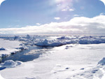
Climate Change
Forecast: Big snow in Eastern U.S. cities
by Staff Writers
State College, Pa. (UPI)
 disclaimer: image is for illustration purposes only |
After a 2011-2012 winter that saw little snow, the mid-Atlantic and southern New England states will get a snow dump this winter, forecasters say.
Above-normal snowfall during winter 2012-2013 is forecast for the major I-95 cities including New York, Philadelphia, Baltimore and Washington, AccuWeather.com reported Wednesday.
“The I-95 cities could get hit pretty good,” forecaster Paul Pastelok said. “It’s a matter of getting the cold to phase in with the huge systems that we are going to see coming out of the southern branch of the jet stream this year.”
The presence — and strength — of El Nino conditions in the Pacific Ocean are used to project how active the winter season will be, forecasters said.
El Nino warming of ocean water and the air above it causes weather patterns to change globally, and El Nino winters feature a strong southern branch of the jet stream across the United States, AccuWeather.com said.
When the strong southern jet stream phases with the northern branch of the jet stream, meteorologists said, big storms can hit the east coast.
Related Links
It’s A White Out at TerraDaily.com
Greenland ice more resistant to climate change than feared, study shows
by: J. D. Heyes
(NaturalNews) The ice in Greenland appears to be less vulnerable than earlier believed to uncontrolled melting that some scientists and climatologists said would drive up sea levels and lead to a host of environmental issues, according to a new study that found a spike in loss of ice had declined.
Kurt Kjaer of the University of Copenhagen, lead author of the new study, said in a statement of findings recently in the journal Science that “it is too early to proclaim that the ‘ice sheet’s future doom'” due to climate change being imminent.
Researchers from the Netherlands, Britain and Denmark wrote that they examined aerial photos taken from aircraft which showed stark glacial thinning in northwest Greenland between 1985 and 1993. They also said another spike in loss of ice took place between 2005 and 2010.
A wash of warm air
From that data some scientists, environmentalists and climatologists had concluded that Greenland could be headed towards a perpetual, endless meltdown of its glacial ice – a phenomenon many experts have attributed to man-made global warming.
In fact, in the latter part of July, scientists at NASA recorded an unprecedented warming event in Greenland, where – over the span of just a few days – nearly the country’s entire massive ice sheet began melting.
“You literally had this wave of warm air wash over the Greenland ice sheet and melt it,” NASA ice scientist Tom Wagner told reporters in describing the phenomenon.
The ice melt area expanded from 40 percent to nearly 97 percent over the span of four days, said NASA scientists, adding that three separate satellites recorded the occurrence that they have yet to be able to explain.
“When we see melting in places that we haven’t seen before, at least in a long period of time, it makes you sit up and ask what’s happening?” said NASA chief scientist Waleed Abdalati.
Until then, scientists had only witnessed a 55 percent melt. Even Greenland’s coldest region, which is also its highest, experienced melting; according to ice core readings, that hasn’t happened since 1889 and only occurs about once every 150 years, The Associated Press reported.
Many scientists and environmentalists have, for years, believed that man-caused activities have contributed to global warming, a debate that has been given new life this summer as record heat blanketed – and continues to blanket – much of the nation.
NASA scientist James Hansen said earlier this month that the likelihood of such temperatures occurring from the 1950s through the 1980s was about 1 in 300, but that likelihood has increased to 1 in 10 today.
“This is not some scientific theory. We are now experiencing scientific fact,” he told AP.
Still, the results of the recent study by Kjaer and his team appears to have at least muddled the debate, for they do not jibe with earlier projections that Greenland’s ice caps – which would raise global sea levels by seven meters if all of it did melt – are on an unstoppable, man-caused course to extinction.
More droughts, heat waves coming?
“It starts and then it stops,” Kjaer told Reuters in reference to the periods of ice loss. “This is a break from thinking that it is something that starts, accelerates and will consume Greenland all at once.”
And, since the sudden melting phenomenon NASA witnessed last month, Greenland’s ice seems to be freezing again.
That said, Kjaer noted in the study that the polar nation’s ice sheet did not get bigger in the pause between the spurts of ice loss.
A panel of United Nations climate scientists still maintains that man-caused activities are creating warming conditions around the world. They say that’s being caused mainly by the burning of fossil fuels, and that the activity will eventually lead to more flooding, rising seas, droughts and heat waves.
Sources:
************************************************************************************************************
Solar Activity
3MIN News August 15, 2012: Sprites, Floods, Sunspot Analysis
Published on Aug 15, 2012 by Suspicious0bservers
Earthquake/Solar Flare Watch: http://youtu.be/zd7Z6dmABf8 [August 12-18, 2012]
[EXPLANATION Video For Earthquake Watches] Last Quake Watch: http://youtu.be/SMiHsOYwdCs
TODAY’S LINKS
Sprites: http://www.nasa.gov/mission_pages/sunearth/news/seeing-sprites.html
STANFORD VLF GROUP: http://vlf.stanford.edu/
Reuters – Japan Flooding: http://youtu.be/Y-m8uh4Jbl4
Nigeria Flood: http://allafrica.com/stories/201208140218.html
Fukushima Butterflies: http://ca.news.yahoo.com/fukushima-caused-mutant-butterflies-scientists-07134…
Heat Bloom: http://weather.unisys.com/surface/sfc_con_heat.gif
REPEAT LINKS
Spaceweather: http://spaceweather.com/ [Look on the left at the X-ray Flux and Solar Wind Speed/Density]
HAARP: http://www.haarp.alaska.edu/haarp/data.html [Click online data, and have a little fun]
SDO: http://sdo.gsfc.nasa.gov/data/ [Place to find Solar Images and Videos – as seen from earth]
SOHO: http://sohodata.nascom.nasa.gov/cgi-bin/soho_movie_theater [SOHO; Lasco and EIT – as seen from earth]
Stereo: http://stereo.gsfc.nasa.gov/cgi-bin/images [Stereo; Cor, EUVI, HI – as seen from the side]
SunAEON:http://www.sunaeon.com/#/solarsystem/ [Just click it… trust me]
SOLARIMG: http://solarimg.org/artis/ [All purpose data viewing site]
iSWA: http://iswa.gsfc.nasa.gov/iswa/iSWA.html [Free Application; for advanced sun watchers]
NASA ENLIL SPIRAL: http://iswa.gsfc.nasa.gov:8080/IswaSystemWebApp/iSWACygnetStreamer?timestamp=…
NOAA ENLIL SPiral: http://www.swpc.noaa.gov/wsa-enlil/
NOAA Bouys: http://www.ndbc.noaa.gov/
RSOE: http://hisz.rsoe.hu/alertmap/index2.php [That cool alert map I use]
JAPAN Radiation Map: http://jciv.iidj.net/map/
LISS: http://earthquake.usgs.gov/monitoring/operations/heliplots_gsn.php
Gamma Ray Bursts: http://grb.sonoma.edu/ [Really? You can’t figure out what this one is for?]
BARTOL Cosmic Rays: http://neutronm.bartol.udel.edu//spaceweather/welcome.html [Top left box, look for BIG blue circles]
TORCON: http://www.weather.com/news/tornado-torcon-index [Tornado Forecast for the day]
GOES Weather: http://rsd.gsfc.nasa.gov/goes/ [Clouds over America]
EL DORADO WORLD WEATHER MAP: http://www.eldoradocountyweather.com/satellite/ssec/world/world-composite-ir-…
PRESSURE MAP: http://www.woweather.com/cgi-bin/expertcharts?LANG=us&MENU=0000000000&…
HURRICANE TRACKER: http://www.weather.com/weather/hurricanecentral/tracker
INTELLICAST: http://www.intellicast.com/ [Weather site used by many youtubers]
NASA News: http://science.nasa.gov/science-news/science-at-nasa/
PHYSORG: http://phys.org/ [GREAT News Site!]
************************************************************************************************************
Space
Earth approaching objects (objects that are known in the next 30 days) |
|||||||||
| Object Name | Apporach Date | Left | AU Distance | LD Distance | Estimated Diameter* | Relative Velocity | |||
| 4581 Asclepius | 16th August 2012 | 0 day(s) | 0.1079 | 42.0 | 220 m – 490 m | 13.48 km/s | 48528 km/h | ||
| (2008 TC4) | 18th August 2012 | 2 day(s) | 0.1937 | 75.4 | 140 m – 300 m | 17.34 km/s | 62424 km/h | ||
| (2012 OP4) | 18th August 2012 | 2 day(s) | 0.1039 | 40.4 | 300 m – 670 m | 22.54 km/s | 81144 km/h | ||
| (2012 EC) | 20th August 2012 | 4 day(s) | 0.0815 | 31.7 | 56 m – 130 m | 5.57 km/s | 20052 km/h | ||
| (2006 CV) | 20th August 2012 | 4 day(s) | 0.1744 | 67.9 | 290 m – 640 m | 13.24 km/s | 47664 km/h | ||
| 162421 (2000 ET70) | 21st August 2012 | 5 day(s) | 0.1503 | 58.5 | 670 m – 1.5 km | 12.92 km/s | 46512 km/h | ||
| (2007 WU3) | 21st August 2012 | 5 day(s) | 0.1954 | 76.0 | 56 m – 120 m | 5.25 km/s | 18900 km/h | ||
| (2012 BB14) | 24th August 2012 | 8 day(s) | 0.1234 | 48.0 | 27 m – 60 m | 2.58 km/s | 9288 km/h | ||
| (2012 FM52) | 25th August 2012 | 9 day(s) | 0.0599 | 23.3 | 510 m – 1.1 km | 17.17 km/s | 61812 km/h | ||
| 66146 (1998 TU3) | 25th August 2012 | 9 day(s) | 0.1265 | 49.2 | 3.0 km – 6.8 km | 16.03 km/s | 57708 km/h | ||
| (2009 AV) | 26th August 2012 | 10 day(s) | 0.1615 | 62.8 | 670 m – 1.5 km | 22.51 km/s | 81036 km/h | ||
| 331769 (2003 BQ35) | 28th August 2012 | 12 day(s) | 0.1585 | 61.7 | 240 m – 530 m | 4.64 km/s | 16704 km/h | ||
| (2010 SC) | 28th August 2012 | 12 day(s) | 0.1679 | 65.3 | 16 m – 36 m | 9.56 km/s | 34416 km/h | ||
| 4769 Castalia | 28th August 2012 | 12 day(s) | 0.1135 | 44.2 | 1.4 km | 12.06 km/s | 43416 km/h | ||
| (2012 LU7) | 02nd September 2012 | 17 day(s) | 0.1200 | 46.7 | 440 m – 990 m | 8.16 km/s | 29376 km/h | ||
| (2012 FS35) | 02nd September 2012 | 17 day(s) | 0.1545 | 60.1 | 2.3 m – 5.2 m | 2.87 km/s | 10332 km/h | ||
| (2012 HG31) | 03rd September 2012 | 18 day(s) | 0.0716 | 27.9 | 440 m – 990 m | 10.33 km/s | 37188 km/h | ||
| (2012 PX) | 04th September 2012 | 19 day(s) | 0.0452 | 17.6 | 61 m – 140 m | 9.94 km/s | 35784 km/h | ||
| (2012 EH5) | 05th September 2012 | 20 day(s) | 0.1613 | 62.8 | 38 m – 84 m | 9.75 km/s | 35100 km/h | ||
| (2011 EO11) | 05th September 2012 | 20 day(s) | 0.1034 | 40.2 | 9.0 m – 20 m | 8.81 km/s | 31716 km/h | ||
| (2007 PS25) | 06th September 2012 | 21 day(s) | 0.0497 | 19.3 | 23 m – 52 m | 8.50 km/s | 30600 km/h | ||
| 329520 (2002 SV) | 08th September 2012 | 23 day(s) | 0.1076 | 41.9 | 300 m – 670 m | 9.17 km/s | 33012 km/h | ||
| (2011 ES4) | 10th September 2012 | 25 day(s) | 0.1792 | 69.8 | 20 m – 44 m | 12.96 km/s | 46656 km/h | ||
| (2008 CO) | 11th September 2012 | 26 day(s) | 0.1847 | 71.9 | 74 m – 160 m | 4.10 km/s | 14760 km/h | ||
| (2007 PB8) | 14th September 2012 | 29 day(s) | 0.1682 | 65.5 | 150 m – 340 m | 14.51 km/s | 52236 km/h | ||
| 226514 (2003 UX34) | 14th September 2012 | 29 day(s) | 0.1882 | 73.2 | 260 m – 590 m | 25.74 km/s | 92664 km/h | ||
| (1998 QC1) | 14th September 2012 | 29 day(s) | 0.1642 | 63.9 | 310 m – 700 m | 17.11 km/s | 61596 km/h | ||
|
|||||||||
*************************************************************************************************************
Technological Disasters
| Today | Technological Disaster | USA | State of New York, Brentwood [Prospect Drive] | |
|
Technological Disaster in USA on Thursday, 16 August, 2012 at 08:18 (08:18 AM) UTC.
| Description | |
| Authorities are now investigating the reason behind the explosion and the ensuing collapse of the house, but so far, they have not found any. The house was a two-story building that was located on Prospect Drive in Brentwood and it was razed to the ground due to the explosion. The collapse took place before noon on Tuesday and at that time several people were around the house, due to which the number of people injured was quite high. An 18-month-old toddler by the name of Rah-quan Palmer died in the collapse, while his parents, Christina Morgan, 23, and Rashamel Palmer, 28, were badly injured. Both Palmer and Morgan are still hospitalized along with their tenants, Calvin Harris, 23 and Irving Justiniano, 63.In addition to the occupants of the house, a State Farm Insurance agent and a plumber were also injured in the collapse because they were present at the house at that time to assess a recent claim submitted for flooding of the house. These two people are identified as 46-year-old Patricia Salegna-Maqueda and 48-year-old Michael Ray. A total of 11 people were injured outside the house. They include seven police officers, two firefighters and two neighbors. The injuries of the people outside the house were minor and they were released after getting treated from the hospital. One of the neighbors described a very tragic and chaotic scene when the house collapsed. “One of them came out, and his clothes were all ripped, his face was all bloody,” said Anthony Acevedo, according to a report by nbcnews.com. “The mother of the baby that came out, she was bloody and crying, and she kept screaming, ‘My baby’s in there, my baby’s in there.'”The firefighters promptly arrived at the scene to extricate people from under the rubble, but sadly, the toddler had already died when they got to him. The cause behind this house collapse is still being investigated, but it has been reported that the house was in a very bad condition and the owner had already been summoned for quite a few times for code violations. |
| Today | Technological Disaster | Democratic Republic of the Congo | Province of Orientale , [AngloGold Ashanti and Randgold Gold Mine, Mambasa territory] |  |
|
Technological Disaster in Democratic Republic of the Congo on Thursday, 16 August, 2012 at 05:23 (05:23 AM) UTC.
| Description | |
| About 60 miners died when a shaft in which they were working collapsed in a remote part of northeastern Democratic Republic of Congo, a UN-backed radio station said on Wednesday. The miners were 100 meters underground when the accident occurred on Monday in Mambasa territory in Orientale Province. Authorities in the Central African nation were not immediately available to comment. Mining companies AngloGold Ashanti and Randgold operate in the region, which is known to be rich in tin and gold. Hundreds of thousands of people in eastern Congo make a living in artisanal mines, where safety precautions are almost nonexistent and accidents are common. |
*************************************************************************************************************
Biological Hazards / Wildlife
| Today | Biological Hazard | South Korea | Multiple region, [All coastal areas] | |
|
Biological Hazard in South Korea on Thursday, 16 August, 2012 at 14:38 (02:38 PM) UTC.
| Description | |
| Holidaymakers and fishermen are worried about giant toxic jellyfish showing up in Korea’s coastal areas in record numbers this summer. A girl was killed earlier this month and more than 500 people have been stung by jellyfish in the seas around Busan this season. The southern resort island of Jeju saw more than 130 people stung. Although there have been reports in China and Southeast Asia of deaths caused by poisonous jellyfish, Korea was considered relatively safe from them. However, the scare is spreading following the recent surge in accidents, including the first death associated with jellyfish. “The number of jellyfish species that can be found in Korea is 124, and among them 100 are poisonous. Thus Korea is no longer a safe zone. Furthermore, the most frequently seen are Nomura’s jellyfish and moon jellyfish,” said Yoon Won-duk, a researcher at National Fisheries Research and Development Institute. According to Yoon, the one that killed the girl is most likely Nomura’s jellyfish. Last year, nuclear power plants in Scotland, Japan, Israel and Florida were forced to shut down because the free-moving animals were clogging the water inlets.The swarming of jellyfish has been predicted by many experts since early 2000. In 2002, Japan saw blooms of jellyfish in its coastal waters, and in 2009 Australian marine scientist Anthony Richard foresaw a near future in which marine biodiversity would be dominated by jellyfish. Experts give several causes to the somewhat sudden global increase of jellyfish, all of which have to do with the changing oceanic environment. Warmer temperatures caused by global warming, salinity changes, ocean acidification and pollution all help jellyfish thrive. “Not only higher ocean temperature but also overfishing and pollution have increased the jellyfish population. As the temperature rises even further, more jellyfish will be moving northward,” said Yoon. There are still some weeks left until the summer heat wanes, and in the meantime, beaches will still be the favorite destinations of people on vacation. If one is stung by jellyfish, a few measures can be taken to alleviate the situation. First, get the person out of the water and wash the spot immediately with seawater or running water. Do not rinse with vinegar unless stung by Jimble; it can reactivate stinging cells. Apply tetracycline cream to relieve itching and swelling and use ice packs to relieve sever pain or welts. Call 119 if the person displays signs of a severe allergic reaction. | |
| Biohazard name: | Nomura s Jellyfish invasion (strongly toxic) |
| Biohazard level: | 0/4 — |
| Biohazard desc.: | This does not included biological hazard category. |
| Symptoms: | |
| Status: | confirmed |
|
|
|
| 16.08.2012 | Biological Hazard | USA | State of Texas, [Dallas County] | |
|
Biological Hazard in USA on Wednesday, 15 August, 2012 at 03:14 (03:14 AM) UTC.
| Description | |
| Nine people have died from a West Nile virus outbreak that infected 175 people in Dallas County, Texas, prompting officials to declare a state of emergency. The emergency was declared on Friday by Dallas County Judge Clay Jenkins, the county’s director of homeland security and emergency management. “This declaration will expand our avenues DisasterNew assistance in our ongoing battle with West Nile virus,” Jenkins said. “While we are busy doing everything we can to keep residents well informed and as protected as possible, we need your help.” Jenkins also said that planes would be spraying insecticide over areas most effected by the virus, which is spread by mosquitoes. He assured citizens that the insecticide is safe and that the planes will be precise in their spraying. Tarrant County has also received 146 reported cases of West Nile in the last few weeks. The county has not declared a state of emergency, though. Houston officials are warning residents of an increased threat of the virus. “Houston can definitely expect an increase in West Nile disease,” said Kristy Murray, an infectious disease specialist at the Baylor College of Medicine’s National School of Tropical Medicine, DisasterNews reports. “From mid-August through September is the big season here.” | |
| Biohazard name: | West Nile virus outbreak |
| Biohazard level: | 2/4 Medium |
| Biohazard desc.: | Bacteria and viruses that cause only mild disease to humans, or are difficult to contract via aerosol in a lab setting, such as hepatitis A, B, and C, influenza A, Lyme disease, salmonella, mumps, measles, scrapie, dengue fever, and HIV. “Routine diagnostic work with clinical specimens can be done safely at Biosafety Level 2, using Biosafety Level 2 practices and procedures. Research work (including co-cultivation, virus replication studies, or manipulations involving concentrated virus) can be done in a BSL-2 (P2) facility, using BSL-3 practices and procedures. Virus production activities, including virus concentrations, require a BSL-3 (P3) facility and use of BSL-3 practices and procedures”, see Recommended Biosafety Levels for Infectious Agents. |
| Symptoms: | |
| Status: | confirmed |
*************************************************************************************************************
[In accordance with Title 17 U.S.C. Section 107, this material is distributed without profit, for research and/or educational purposes. This constitutes ‘FAIR USE’ of any such copyrighted material.]


